SERvices
Remote Sensing & Imaging
At Terra Sentinel, we are dedicated to providing top-tier services that cater to your unique needs. Our commitment is to deliver precise, reliable, and actionable data. Trust us to safeguard your investments and support your mission with the power of advanced satellite technology and AI-driven analysis .


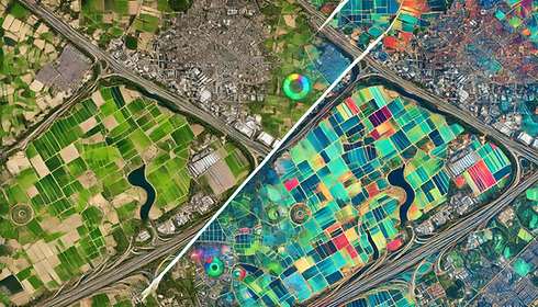
Change Detection
Change detection leverages AI-driven satellite imagery and advanced geospatial analysis to identify and monitor alterations in land use, vegetation, and infrastructure over time. This innovative technology enables landowners to stay informed about their properties, detecting changes such as deforestation, urban encroachment, or crop health fluctuations.
By providing real-time data and actionable insights, change detection empowers landowners to make informed decisions, optimize land management strategies, and protect their investments. Whether tracking environmental impacts, assessing land value, or ensuring regulatory compliance, this tool offers a powerful solution for sustainable and proactive land monitoring.
Environmental Monitoring
Environmental monitoring harnesses advanced satellite imagery and data analysis to track critical ecological changes, such as deforestation, pollution, and conservation efforts. This technology provides a clear view of environmental impacts, enabling timely interventions to safeguard ecosystems.
By identifying areas at risk, monitoring air and water quality, and assessing the effectiveness of conservation projects, landowners, governments, and organizations can take proactive steps to ensure environmental sustainability. From preserving biodiversity to combating climate change, environmental monitoring empowers stakeholders with the tools to protect and restore the planet’s natural resources.

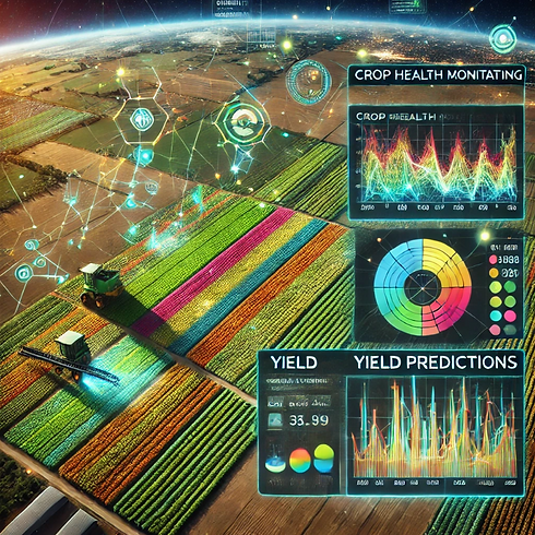
Agricultural Insights
Agricultural insights utilize cutting-edge satellite imagery and AI-driven analysis to provide valuable data on crop health, yield predictions, and soil quality. This technology allows farmers and landowners to monitor plant growth, detect early signs of disease or stress, and optimize resource allocation such as water, fertilizers, and pesticides.
By delivering precise and actionable information, agricultural insights help improve yields, reduce costs, and promote sustainable farming practices. From planning harvests to enhancing soil fertility, this tool empowers agricultural stakeholders to maximize productivity while preserving the land for future generations.
Custom Solutions
Custom solutions provide specialized satellite imagery and data analysis designed to meet the unique requirements of specific industries or projects. Whether for urban planning, forestry management, disaster response, or real estate development, this service offers precisely the information needed to drive effective decision-making.
By delivering industry-specific insights—such as flood risk assessments, infrastructure monitoring, or land-use planning—custom solutions enable stakeholders to achieve their goals with precision and confidence. Empower your project or business with data tailored to your unique challenges and objectives.
